

Ready to Find Your Place at Colony Ridge?
What's Happening
Deprecated: Using ${var} in strings is deprecated, use {$var} instead in /home/colony/public_html/administrator/components/com_easyblog/includes/stylesheet/compilers/lessc.php on line 1343
Deprecated: Using ${var} in strings is deprecated, use {$var} instead in /home/colony/public_html/administrator/components/com_easyblog/includes/stylesheet/compilers/lessc.php on line 1689
Deprecated: Using ${var} in strings is deprecated, use {$var} instead in /home/colony/public_html/administrator/components/com_easyblog/includes/stylesheet/compilers/lessc.php on line 1689
How Drone Technology Is Transforming Land Development
The way communities are planned and developed has changed dramatically over the years, and one of the most exciting advancements in modern land development is the use of drone technology. What once required weeks of surveying and data collection can now be accomplished more efficiently, accurately, and safely with the help of drones.
Before a single road is designed or a lot is mapped out, engineers must first understand the land. Every property has its own unique characteristics, from changes in elevation and drainage patterns to natural features that must be considered during the planning process. Drones provide a bird's-eye view of the land, allowing engineers to gather detailed information that helps guide every decision that follows.
Equipped with advanced sensors and imaging technology, drones can scan large areas of land and create highly accurate maps and models. These scans provide valuable data about terrain, vegetation, water flow, and elevation changes. By having this information early in the development process, engineers can identify potential challenges and opportunities before construction begins.
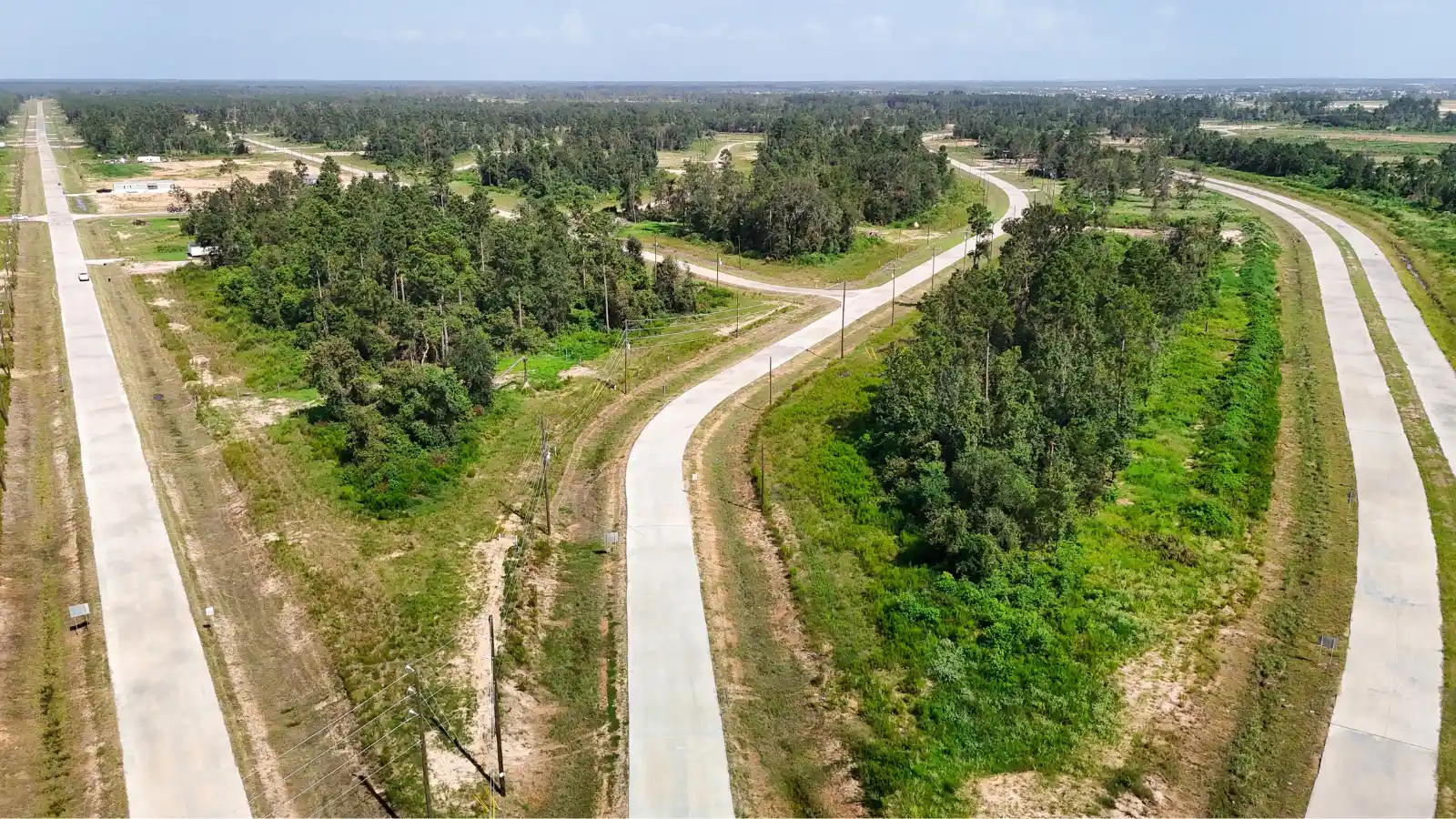
One of the greatest benefits of drone technology is efficiency. Large tracts of land that may have taken survey teams days or even weeks to analyze can now be documented in a fraction of the time. This allows development teams to move forward more quickly while still maintaining the high level of accuracy required for successful planning.
Drone technology also helps engineers work more responsibly with the natural environment. By understanding the land's existing conditions, planners can design neighborhoods that complement the landscape rather than fight against it. This approach helps preserve natural features, improve drainage systems, and create safer, more sustainable communities for future residents.
Safety is another major advantage. Instead of requiring personnel to access difficult terrain or potentially hazardous areas, drones can gather critical information remotely. This reduces risk while still providing engineers with the data they need to make informed decisions.
At Colony Ridge, innovation plays an important role in helping transform raw land into thriving communities. Advanced tools such as drones allow engineers to study the land in greater detail, ensuring that every development begins with a strong understanding of the property's unique characteristics. This information helps create neighborhoods that are designed with families, safety, and long-term growth in mind.
Frequently Asked Questions
If you are a member of the media with an inquiry about Colony Ridge, please see the FAQ below.
Or email us at: [email protected]
2026 Lawsuit Settlement Agreement
- A Message To Our Customers About The Lawsuit Settlement Agreement (English)
- A Message To Our Customers About The Lawsuit Settlement Agreement (Spanish)
- Complete 2026 Lawsuit Settlement Agreement
If you have other questions not found in the Message to Our Customers, please email us here.
Does Colony Ridge have a Nondiscrimination Policy and Complaint Procedure (NPCP)?
Yes! Colony Ridge is committed to fair, equitable, and nondiscriminatory practices in all lending, credit, and residential land-sale activities. You can read the full disclosure at the following link.
https://www.colonyridge.com/npcp
Community & Living
What makes Colony Ridge unique?
Colony Ridge provides a path to land ownership through flexible financing options with no credit checks. Families can build equity and create long-term stability, often for less than the cost of renting.
Who lives in Colony Ridge?
Our community is home to hardworking families from all walks of life. Many are young families seeking more space, safer neighborhoods, and a better future for their children.
Can I build a home on my lot?
Yes. Residents have the freedom to begin with a mobile or manufactured home and later build a custom home when they are ready. We offer flexibility so families can grow on their own timeline.
What amenities are available in the community?
Residents enjoy access to public parks, sports fields, splash pads, and a central Administration Building that hosts community events, church services, and educational programs.
Are there businesses within Colony Ridge?
Yes. Our community is home to several nationally known brands, as well as many small businesses. These businesses make it convenient for residents to access goods and services close to home.
Infrastructure & Services
Are utilities available on every lot?
Yes. When fully developed and ready for county permitting, utilities are available on every lot.
Residents will need to arrange connections with the various third-party utility companies. Our team offers support through this process.
How is drainage handled in Colony Ridge?
The community features a fully engineered, Liberty county-approved drainage system that complies with the Liberty County Rules for Subdivision & Development. We work with Liberty County officials and third-party engineers to expand and maintain proper stormwater management as the area grows.
What is the role of the El Norte POA?
The POA oversees the care of shared amenities such as playgrounds, sports fields, and event spaces. It also coordinates community events and works closely with law enforcement for safety initiatives.
What does the Municipal Management District (MMD) do?
The MMD focuses on long-term infrastructure planning, including road construction, drainage improvements, and other public works that support the growth and sustainability of the communities.
Are new schools being added?
Yes. Colony Ridge has donated land to Cleveland ISD and International Leadership of Texas (ILTexas) to build six schools, including upcoming expansions like ILTexas Liberty High School.
Is commercial development expanding?
Yes. As our population grows, so does commercial interest. Residents will see more shopping, dining, and service-oriented businesses developing throughout the community.
Safety & Security
How Safe Is Colony Ridge?
Colony Ridge remains one of the safest communities of its size anywhere in Texas. Colony Ridge’s calm and safe environment coupled with its schools and recreational areas have attracted thousands of families. The community funds ten full-time Sheriff’s deputies and three full-time constables.
Why does Colony Ridge have its own dedicated law enforcement?
As the community grew, residents and developers worked together to provide extra safety. Our law enforcement presence exceeds the coverage seen in many other rural or suburban neighborhoods.
How are emergencies handled in Colony Ridge?
Emergency services are dispatched through Liberty County’s 911 system. Fire, EMS, and law enforcement services continue to expand with the community’s needs.
How can I report a crime or concern?
Residents can contact the Liberty County Sheriff’s Office Call: 936-336-4500, speak to one of the dedicated constables, or call 911 in an emergency. Regular safety updates are posted at the Administration Building.
Public Perception & Planning
Does Colony Ridge sell homes?
Colony Ridge is a land developer that sells land. We do not sell or build homes.
What kind of businesses are welcome in Colony Ridge?
From convenience stores to restaurants to home services, the community continues to grow into a thriving residential and commercial destination.
How can I learn more or schedule a visit?
Visit our office located in the community, attend one of our community events, or schedule a tour with our sales team. You’ll see available lots, meet current residents, and get a true feel for what it means to be part of the community.
Watch Testimonials

